
MONDAY QUICK FORECAST:
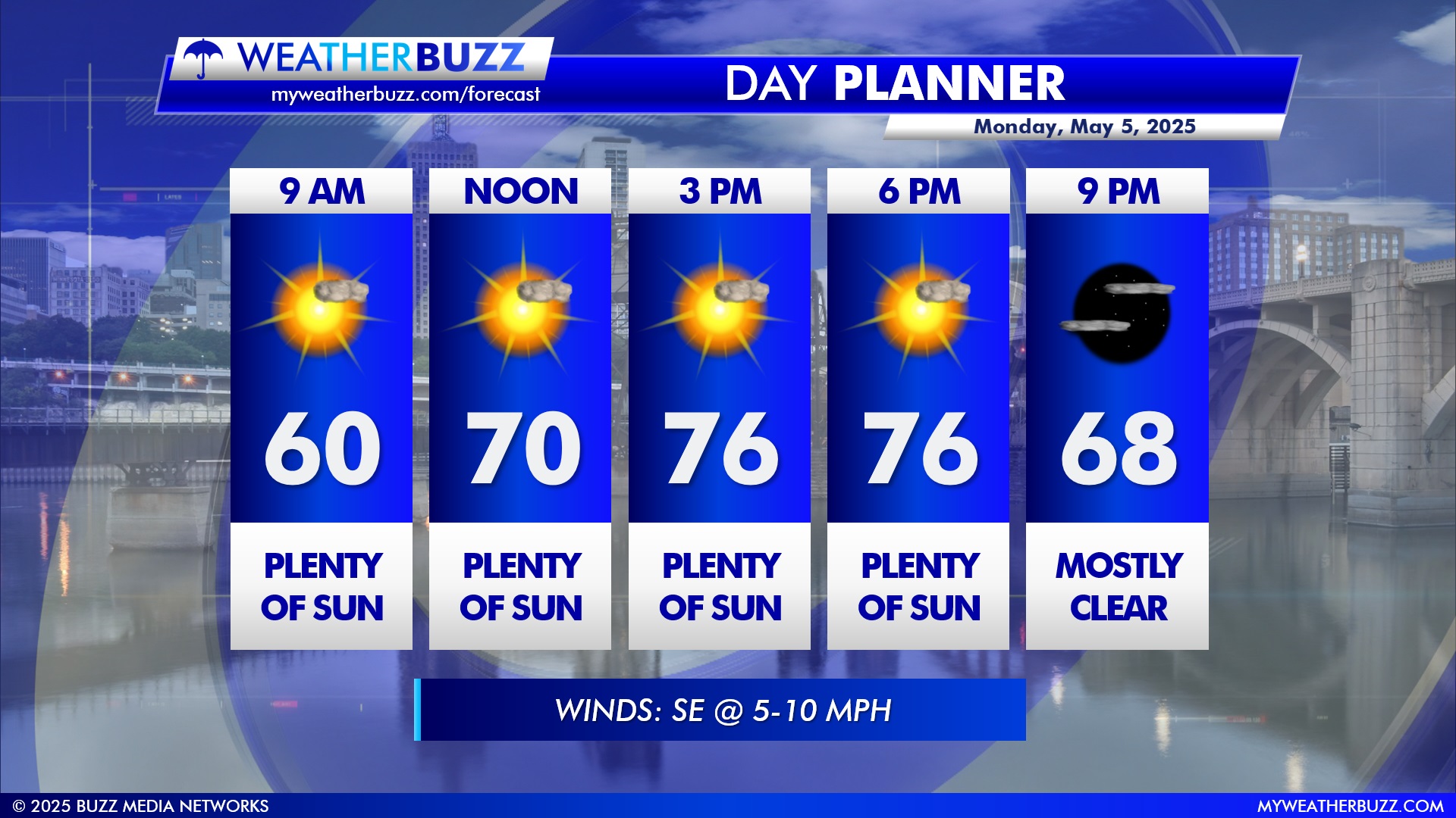
The forecast for Monday calls for plenty of sunshine throughout the day, with high temperatures near 76°. Winds will remain calm from the SE at 5-10 MPH. Monday will almost be a repeat forecast of what we had on Sunday. Our average temperatures for this time of the year are in the mid-60s for highs and mid-40s for lows.
LOCAL FORECAST:
It’s a picture-perfect Monday ahead with plenty of sunshine throughout the day. Temperatures start around 60° at 9 AM and climb to a warm 76° by mid-afternoon, holding steady through 6 PM. Winds will be light out of the southeast at 5–10 mph. Expect mostly clear skies by 9 PM, with temperatures easing back into the upper 60s. As a reminder, you can always find the latest hourly forecast for your location right here on our website.
REGIONAL FORECAST FOR MONDAY:
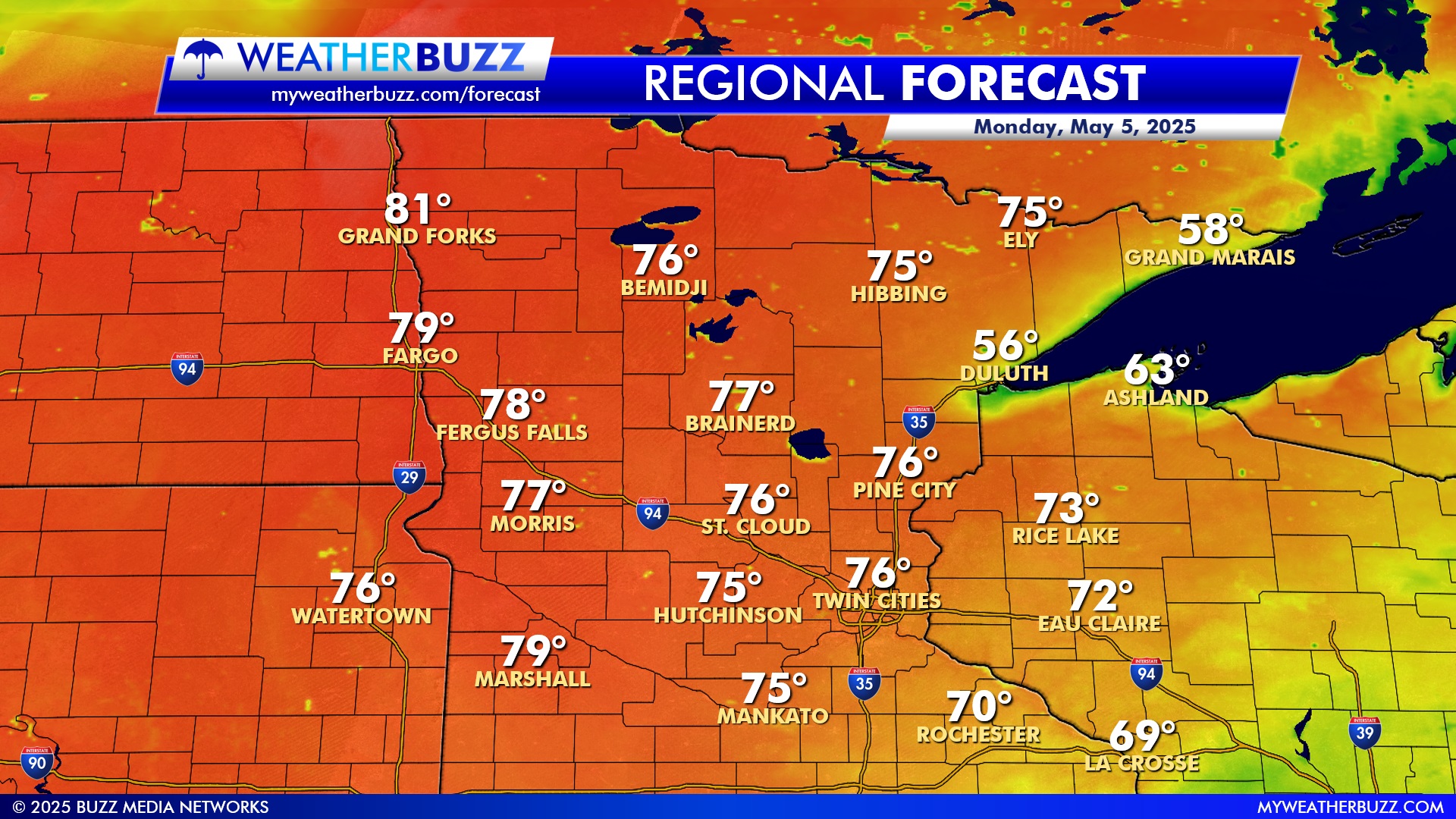
Temperatures across the region on Monday will be mild to warm, with most areas seeing highs in the 70s. The warmest spots include Grand Forks and Fargo, where highs will reach the upper 70s to low 80s. From St. Cloud to the Twin Cities, much of central and southern Minnesota will settle comfortably in the mid-70s. Cooler air holds on near Lake Superior, with highs only in the 50s around Duluth and Grand Marais.
Western Minnesota and eastern North Dakota will stay warmer, with cities like Morris and Marshall peaking in the upper 70s. Wisconsin will range from the low 70s in Rice Lake and Eau Claire to the upper 60s in La Crosse. Overall, it’s a pleasant spring day with sunshine and seasonal warmth spreading throughout the upper Midwest. As a reminder, you can always get the latest extended forecast for your exact location on our website by clicking here.